
The comparison of aerial images taken at different times is a cost-effective way to detect landscape changes. In the WBS module Remote Sensing, changes in approximately 7000 sites representing all biotopes of national importance are investigated in this way. An early-recognition system enables federal and cantonal offices for the environment to identify positive and negative changes and, if necessary, to initiate measures.
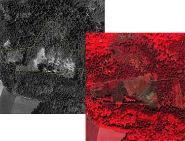
Black-and-white stereoscopic aerial photographs taken at the time of the inventory in the 1980s and 1990s are compared with recent colour infrared stereoscopic photographs.
The interpretation of changes is carried out manually by comparing the two images using a 3D screen. The data quantify both negative processes (e.g. shrub encroachment due to land-use abandonment), as well as positive developments following nature conservation measures.
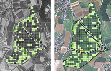
Two slightly different protocols are used to evaluate accuratly the evolution on aerial images, both reproducibles and allowing the spatial differentiation of changes within sites. For dry grasslands, raised bogs and fens, amphibian spawning sites and alpine floodplains, a 50m x 50m grid was laid over each site. Within each grid cell, simple indicators such as the percentage cover of woody plants and the occurence of infrastructure like roads ans buildings are visually estimated.
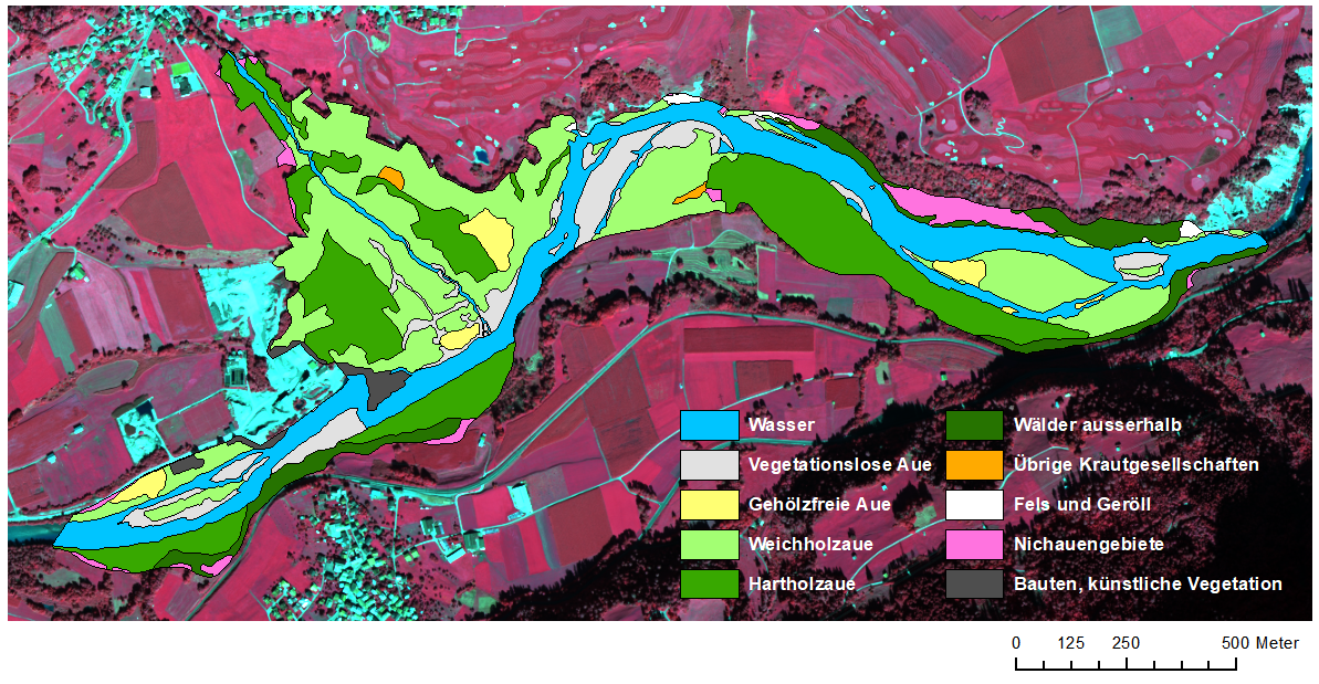
For riparian and lakeside floodplains as well as for river deltas of national importance, the interpretation is based on formations, with the assessment of categories like gravel banks without vegetation, and different riparian forest types. The interpretation of each site is repeated every six years.
The cantons have access to the aerial photo interpretation data and the early-recognition system via the Virtual Data Centre (VDC).